US Map / Printable US Maps / Worksheet
US Map Worksheet and Answer Key
The materials are two sheets and take a minute to print. The order you teach the states in is what decides whether any of it sticks.
The two sheets a labeling worksheet needs
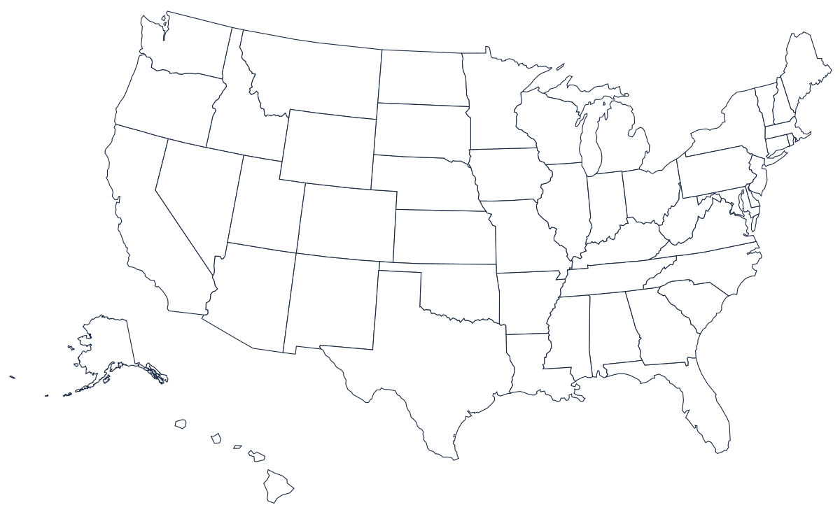
A US map worksheet is two files, not one. The blank map with state borders is the sheet the class writes on: every internal line is drawn, no name appears anywhere, and there is white space above and below the artwork for a name and a date. The labeled US map is the answer key — the identical artwork with every state named — so a student can mark their own sheet against it, or a marker can check thirty of them quickly. Print the blank one per student and one key per pair, and keep a laminated key at the front of the room.
If you want the class to draw the borders rather than fill them in, use the outline map instead: national coastline and land border only, nothing inside. It is a much harder exercise and it is the one that exposes who has actually learned the shapes.
Two maps that turn the blank sheet into a different lesson
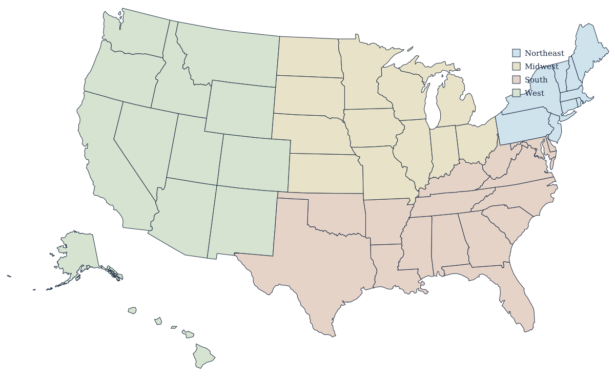
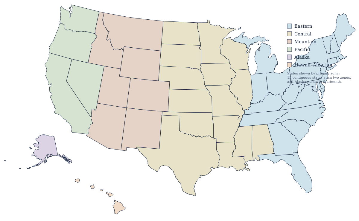
The same blank map supports more than a naming drill. The regions map groups the states into the four census regions — Northeast, Midwest, South and West — and works as a shading exercise: hand out the blank map, give the four region names, and have the class color the country in before a single state name is written. The time zones map does the same job with a different question, since the zone boundaries mostly follow state lines but not always, and the places where a state is split make for a genuine discussion rather than memorisation.
Both are SVG files that print on a single sheet. Neither is offered as a PDF; open them in a browser and print from there, or place them in a document alongside the blank map to build a two-page handout.
How to sequence a labeling lesson
The order matters more than the materials. Labeling fifty states alphabetically is the worst possible approach and it is the one most worksheets encourage.
Start with regions. Have the class divide the blank map into four colored blocks before any names go on it. This gives them a frame to hang everything else on and it makes later mistakes recoverable: a student who puts Iowa in the wrong place but the right region is much closer than one who has it in the South.
Then take the distinctive shapes. Florida, Texas, California, Michigan, Louisiana, Oklahoma and Alaska can each be identified from silhouette alone by anyone who has seen them twice, and they anchor the corners and edges of the map. Getting eight or ten obvious states down early means the remaining blanks are surrounded by known ones.
Fill in the interior next. The square western and Plains states are hard to tell apart individually but easy in a row, so teach them as sequences — the tier from Montana across to Minnesota, the tier from Arizona across to Arkansas — rather than one at a time.
Leave the Northeast until last, and give it its own sheet. Eight states are packed into a corner smaller than Missouri, and at country scale several of them are a few millimetres across. That is exactly what a per-state printout is for: hand out Connecticut, Rhode Island, Vermont and New Hampshire at full page size and the distinctions become obvious in a way they never are on the national map.
Finish on screen. The US map quiz marks itself, and the hardest states quiz is a fair measure of whether the lesson worked; the capitals quiz is the natural follow-on once the states themselves are secure.
Single-state worksheets
Every state has its own printable outline, sized to fill a page, with a paragraph on what its borders actually follow — rivers, survey lines, parallels, coastline. They work as homework, as a per-student assignment for a group project, or as the remedial sheet for the states a class keeps missing. Each one also links to a county map for a second, harder labeling exercise.
- Alabama
- Alaska
- Arizona
- Arkansas
- California
- Colorado
- Connecticut
- Delaware
- Florida
- Georgia
- Hawaii
- Idaho
- Illinois
- Indiana
- Iowa
- Kansas
- Kentucky
- Louisiana
- Maine
- Maryland
- Massachusetts
- Michigan
- Minnesota
- Mississippi
- Missouri
- Montana
- Nebraska
- Nevada
- New Hampshire
- New Jersey
- New Mexico
- New York
- North Carolina
- North Dakota
- Ohio
- Oklahoma
- Oregon
- Pennsylvania
- Rhode Island
- South Carolina
- South Dakota
- Tennessee
- Texas
- Utah
- Vermont
- Virginia
- Washington
- West Virginia
- Wisconsin
- Wyoming
Printing advice for all of these is on the Letter and A4 page; for a wall-sized copy see printing a US map as a poster. The complete list of downloads is on the printable US maps hub, and the country maps themselves live on the blank US map page.