US Map / Geography / Great Lakes
Great Lakes Map
Four of the five Great Lakes are half Canadian; only Lake Michigan is entirely American.
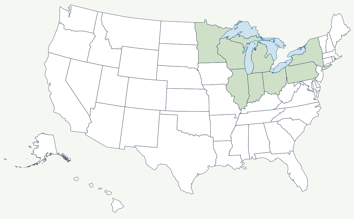
The Great Lakes hold roughly a fifth of the world's surface fresh water, drain through a single outlet to the Atlantic, and were all carved by the same ice sheet within the last hundred thousand years. Together they cover about 94,000 square miles — more water surface than the land area of most states — and their shoreline is longer than the Atlantic and Pacific coasts of the contiguous United States.
Which states border the Great Lakes?
Eight. Going clockwise from the northwest: Minnesota and Wisconsin on Lake Superior, Michigan on four of the five lakes, Illinois and Indiana at the foot of Lake Michigan, Ohio and Pennsylvania on Lake Erie, and New York on both Erie and Ontario. Michigan is the only state that touches four of them, and Lake Michigan is the only one of the five that lies entirely within the United States; the other four are split with the Canadian province of Ontario.
| Lake | Surface area | Maximum depth | US states on its shore |
|---|---|---|---|
| Superior | about 31,700 sq mi | 1,332 ft | Minnesota, Wisconsin, Michigan |
| Huron | about 23,000 sq mi | 750 ft | Michigan |
| Michigan | about 22,300 sq mi | 925 ft | Michigan, Wisconsin, Illinois, Indiana |
| Erie | about 9,900 sq mi | 210 ft | Michigan, Ohio, Pennsylvania, New York |
| Ontario | about 7,300 sq mi | 802 ft | New York |
Superior is the largest freshwater lake in the world by surface area and holds more water than the other four combined. Erie is the shallowest by a wide margin, which is why it warms fastest, freezes most completely, and buries Buffalo in lake-effect snow — though the region's deepest falls come off Lake Ontario onto the Tug Hill Plateau. Michigan and Huron are joined at the Straits of Mackinac and sit at the same level, so hydrologists often treat them as one lake with two names.
Cities on the lakes
Chicago grew at the short portage between Lake Michigan and the Illinois River — the one place where the Great Lakes basin nearly touches the Mississippi basin — and in 1900 the city reversed the Chicago River to send its sewage the other way. Detroit sits on the strait between Lake Erie and Lake Huron that every ship must pass, which is what the name means and why the French built there in 1701. Cleveland and Toledo turned Erie's south shore into an iron-and-oil coast, fed by ore boats coming down from Superior. Buffalo was the western end of the Erie Canal, and Milwaukee the brewing and machine-tool port on the lake's western shore. Minneapolis is not on the lakes, but the ore that built these cities came from the Minnesota ranges behind Duluth.
How the lakes drew the northern border
The 1783 peace treaty put the boundary with British North America through the middle of four of the five lakes and their connecting channels, which is why the United States has a water border for nearly a thousand miles and why Isle Royale, closer to Ontario than to Michigan, is American. Working out exactly where that midline ran took more than a century of survey and arbitration, and the Boundary Waters Treaty of 1909 finally created the International Joint Commission to manage the water itself. Navigation had to be engineered around two obstacles: the 21-foot drop from Superior to Huron, bypassed by the Soo Locks at Sault Ste. Marie, and Niagara Falls, bypassed by the Welland Canal. The St. Lawrence Seaway, opened in 1959, finally let ocean-going ships reach Duluth, 2,300 miles inland.
The two largest lakes have their own pages: Lake Superior and Lake Michigan. The basin's southern rim touches the Appalachian Mountains in Pennsylvania and New York, and its western edge meets the Great Plains. See the physical geography of the United States, or the state pages for Michigan and Ohio.