US Map / Geography / Great Plains
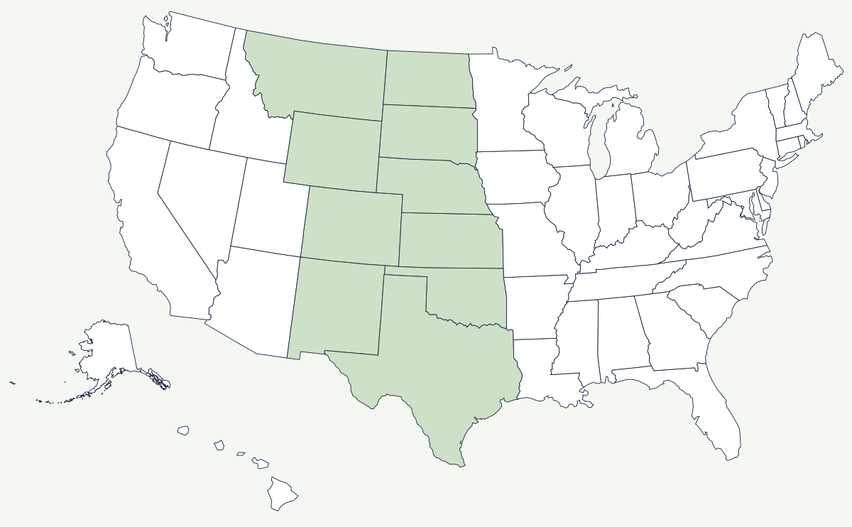
Great Plains Map
The Great Plains tilt eastward so gently — about ten feet to the mile — that the climb is invisible.
Leaving Omaha for Denver you gain about 4,000 feet of elevation and never see a hill worth the name. That is the Great Plains: a wedge of sediment shed off the Rockies, sloping east from roughly a mile above sea level at the mountain front to about 1,500 feet at its eastern edge, dry enough that trees grow only along the rivers and flat enough that the horizon does the work of scenery.
Which states do the Great Plains cover?
Ten, counting the classic definition. From north to south: eastern Montana, North Dakota and South Dakota west of the Missouri, eastern Wyoming, Nebraska, eastern Colorado, Kansas, eastern New Mexico, western Oklahoma and the Texas Panhandle and west Texas. The western boundary is sharp — the Rocky Mountain front — but the eastern one is a matter of rainfall rather than landform, and it slides back and forth with the climate.
| States | Montana, North Dakota, South Dakota, Wyoming, Nebraska, Colorado, Kansas, Oklahoma, New Mexico, Texas |
| Elevation range | roughly 5,000–6,000 ft at the Rocky Mountain front, down to about 1,500 ft at the eastern edge |
| Average slope | about ten feet per mile, eastward |
| Rainfall boundary | near the 100th meridian, historically the line between about 20 inches of rain a year and less |
| Groundwater | the Ogallala Aquifer, underlying parts of eight states and supplying most of the region's irrigation |
| Largest dune field | the Nebraska Sandhills — grass-stabilised dunes covering roughly 20,000 square miles |
| Highest point east of the Rockies | Black Elk Peak in the Black Hills of South Dakota, 7,242 ft |
Notable country within the plains
The Nebraska Sandhills are dunes held in place by grass, useless for the plow and excellent for cattle, which is why one of the largest ranching districts in the country sits in the middle of the corn belt's western edge. The Llano Estacado, on the Texas–New Mexico line, is a tableland so flat and so nearly featureless that early Spanish expeditions reported navigating it by compass; it ends abruptly at the Caprock Escarpment, and Lubbock sits on top of it. The Black Hills rise out of the plains in South Dakota as an isolated dome of old rock — an island of forest, and the reason the 1874 gold expedition broke the treaty that had guaranteed them to the Lakota. On the eastern margin, Wichita and Oklahoma City sit close to the rainfall line that decides whether a farm needs irrigation.
The 100th meridian, and what it cost to ignore it
John Wesley Powell's report to Congress in 1878 made the argument plainly: west of about the 100th meridian, annual rainfall drops below the twenty inches that unirrigated farming needs, and land law written for the humid East would fail there. The 160-acre homestead was a workable farm in Illinois and an insufficient one in western Kansas. Congress went ahead anyway, a run of wet years in the 1880s made the plains look fertile, and the promotional slogan of the day held that rain follows the plow. The drought of the 1890s and then the Dust Bowl of the 1930s settled the question — the deep, dry ploughing of grassland that should never have been broken lifted the topsoil into storms that reached the Atlantic coast. What made large-scale farming possible afterwards was not rain but the Ogallala Aquifer, tapped by center-pivot irrigation from the 1950s on; it is being drawn down faster than it recharges, and in parts of Kansas and the Texas Panhandle the wells have already been abandoned.
The plains begin at the foot of the Rocky Mountains and the Continental Divide, and they are crossed by the Missouri and the Arkansas. Their eastern edge runs up against the Ozarks in Missouri. See the physical geography of the United States, or the state pages for Kansas and Nebraska.