Illinois Map
A state with rivers on three sides and a survey line on the fourth. Capital: Springfield. Largest city: Chicago. Abbreviation: IL.
Illinois at a glance
| Capital | Springfield |
| Largest city | Chicago |
| Abbreviation | IL |
| Population | 12,710,158 (2024 Census estimate) |
| Land area | 55,519 sq mi |
| Region | Midwest (East North Central division) |
| Time zone | Central Time statewide |
| County count | 102 counties |
| Statehood | 1818 (21st state) |
| Borders | Wisconsin, Indiana, Kentucky, Missouri and Iowa, plus Lake Michigan at the northeast corner |
Major cities
Illinois is the most lopsided state in the Midwest. Chicago held 2,721,308 people in 2024, and Cook County, which contains it, held 5,182,617 — more than two-fifths of the state in one county. The collar counties around it push the metropolitan share past two-thirds: DuPage (937,142), Lake (718,604), Will, Kane and McHenry. The next-largest cities — Aurora, Joliet, Naperville and Elgin — are all Chicago suburbs. Everything beyond that ring is called downstate, a word Illinoisans apply to Rockford in the far north as readily as to Cairo at the southern tip; Rockford, Springfield, Peoria and Champaign are the largest places outside the metropolitan area. Springfield has been the capital since 1839, when the legislature moved it from Vandalia, and it is not among the five largest cities in its own state — see the map of US capitals for the other cases.
Geography
The Mississippi River forms the entire western boundary of Illinois, from the Wisconsin line to the state's southern tip; the Ohio River closes it off along the south; and the Wabash forms the lower half of the Indiana border. Only the northern edge is arbitrary, a straight line at 42°30′ north that Congress pushed up from the boundary the Northwest Ordinance had specified, so that the new state of 1818 would reach Lake Michigan. That decision put Chicago and about 60 miles of Lake Michigan shoreline in Illinois rather than Wisconsin.
The interior is glacial till, flattened by successive ice sheets into some of the deepest and most uniform topsoil in the world, which is why the township grid of the Public Land Survey System reads so cleanly here: square counties, square townships, roads on the section lines every mile. Relief is slight. Charles Mound, in the unglaciated corner near Galena, reaches 1,235 feet; the low point is 279 feet at Cairo, where the Ohio joins the Mississippi. That is a range of under a thousand feet across roughly 390 miles of state.
Printable Illinois maps
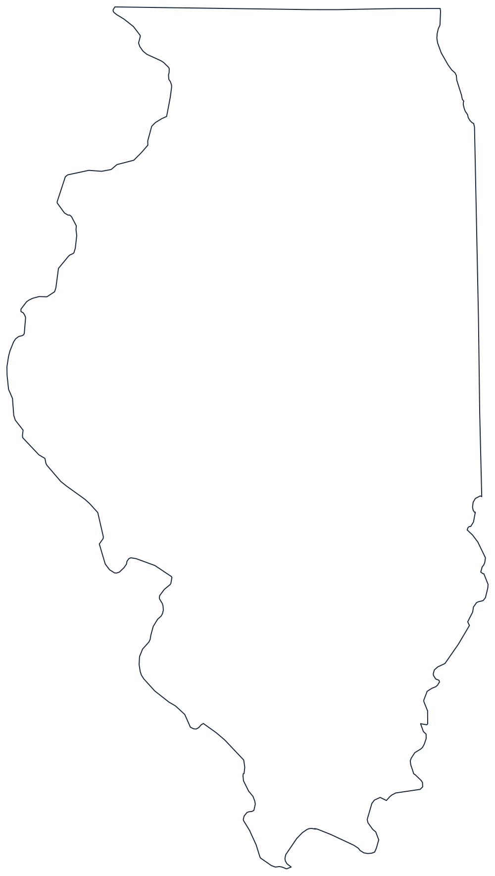
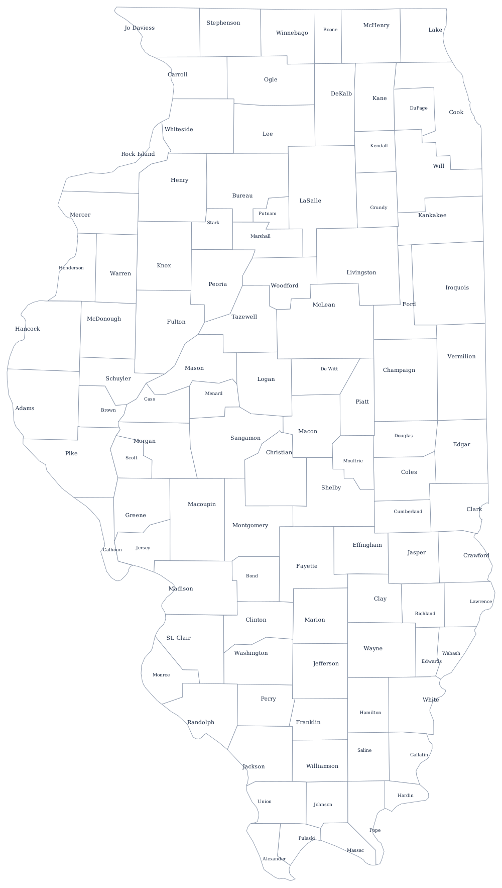
The outline above shows the river boundaries clearly — the ragged west and south against the ruler-straight north. The blank Illinois map page has the same outline sized for Letter and A4 printing, and the Illinois county map shows all 102 counties.
Neighboring states
Cross the Mississippi west into Iowa or Missouri, the Wabash east into Indiana, or the Ohio south into Kentucky; the northern line runs straight into Wisconsin. Illinois is one of the five East North Central states of the Midwest. For the wider picture, return to the US map with states or try the Midwest map quiz.