US Map / Geography / Continental Divide
Continental Divide Map
Rain that falls a few feet apart on this line ends up in oceans three thousand miles apart.
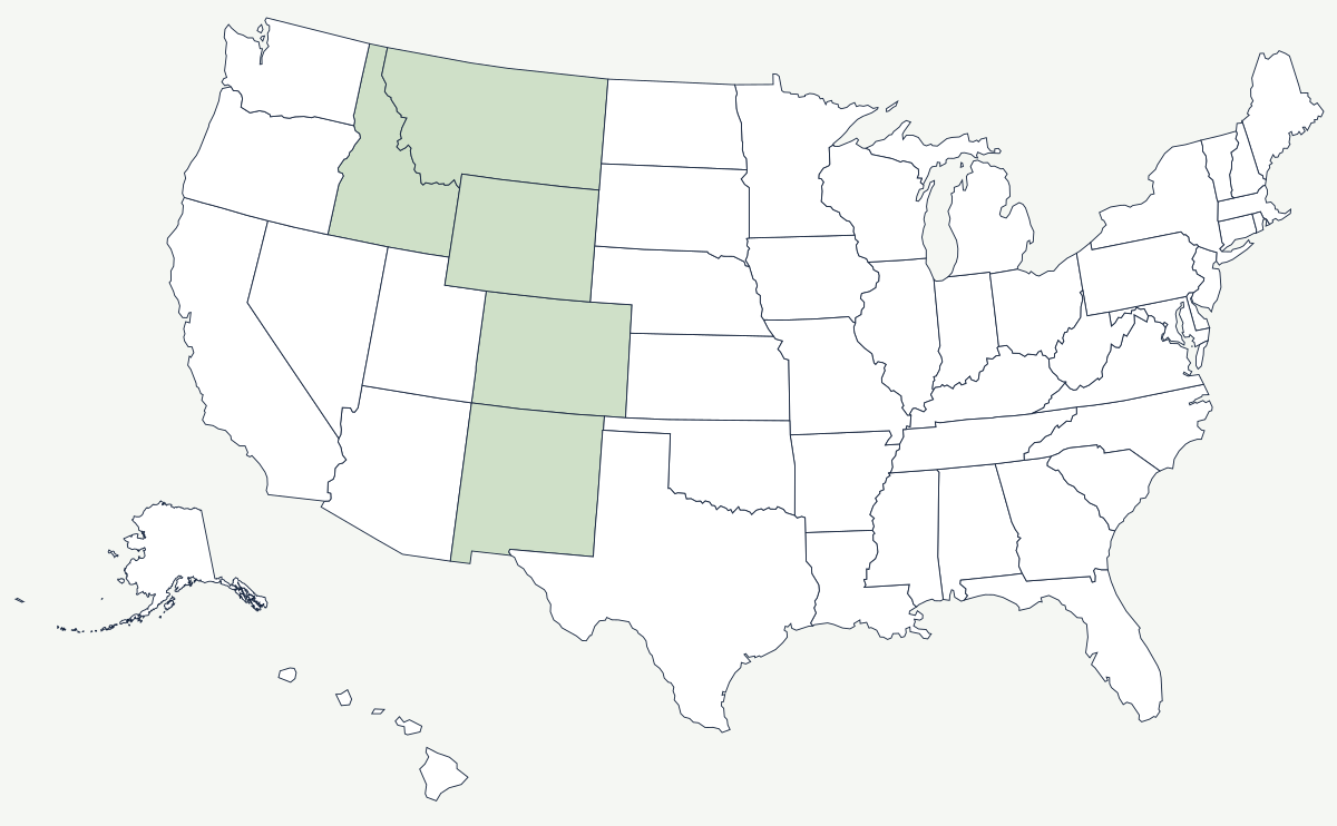
The Continental Divide is not a mountain range but a line drawn along whichever ridge happens to separate water flowing to the Pacific from water flowing to the Atlantic and the Gulf of Mexico. For most of its American length it follows the crest of the Rockies, but it wanders badly — crossing low sagebrush passes, doubling back, and in one place splitting in two around a basin that drains to neither ocean.
Which states does the Continental Divide cross?
Five, in the contiguous United States. It enters from Canada at Glacier National Park in Montana, runs south and west along the Bitterroot country, and turns southeast to the Yellowstone corner of Wyoming — and for a long stretch of that route it is the Montana–Idaho state line itself, one of the few American borders defined by a watershed rather than a survey. It crosses Wyoming through the Wind River Range and South Pass, runs the length of Colorado along the highest part of the Rockies, and continues through western New Mexico into Mexico. West of the Divide, water reaches the Pacific through the Columbia and the Colorado; east of it, through the Missouri, the Arkansas and the Rio Grande.
| States crossed | Montana, Idaho, Wyoming, Colorado, New Mexico |
| Doubles as a state line | much of the Montana–Idaho boundary |
| Hydrological apex | Triple Divide Peak in Glacier National Park, Montana, where water parts three ways — Pacific, Gulf of Mexico and Hudson Bay |
| Lowest crossing in the northern Rockies | Marias Pass, Montana — 5,213 ft |
| Most important historic crossing | South Pass, Wyoming — about 7,400 ft, broad enough that wagons crossed without a climb |
| Highest highway tunnel | the Eisenhower Tunnel under the divide in Colorado, about 11,150 ft — the highest point on the Interstate system |
| Anomaly | the Great Divide Basin in Wyoming, where the line splits and the water inside reaches no ocean at all |
| Long trail | the Continental Divide Trail, roughly 3,100 miles from Mexico to Canada |
The passes that decided the routes
South Pass is the reason the overland trails exist. It is a twenty-mile-wide sagebrush saddle at the southern end of the Wind River Range, so gently graded that emigrants regularly asked their guides when they would reach the divide and were told they had crossed it that morning. The Oregon, California and Mormon trails all used it. Marias Pass, in the north, is the lowest crossing in the northern Rockies at 5,213 feet; it was known to the Blackfeet, missed by railroad surveyors for decades, and finally used by the Great Northern in 1891. Colorado's crossings are all high and all difficult: the Moffat Tunnel bores under the divide west of Denver, Trail Ridge Road climbs over it above 12,000 feet, and Interstate 70 goes under it through the Eisenhower Tunnel. In New Mexico the divide is so low and so vague near Albuquerque's longitude that you can drive across it without noticing.
Why a drainage line matters more than a ridge
Which side of the divide you are on determines whose water you are using, and in the West that is a legal question. Denver sits east of the line but takes a large share of its supply from the Colorado River basin on the west side, pumped and bored through the mountain in tunnels built for the purpose — the same is true of Front Range farms and of cities on both sides of the Wyoming and New Mexico segments. Every interstate river compact begins by asking where the divide runs. It also settled a state line: rather than run a meridian through impossible country, Congress gave Montana and Idaho the Divide and the Bitterroot crest as their boundary, which is why Idaho ended up with its long northern panhandle and Montana with the plains behind the mountains.
The Divide runs along the spine of the Rocky Mountains and sorts the water between the Colorado and Snake on one side and the Missouri and Rio Grande on the other. East of it the land falls away into the Great Plains. See the physical geography of the United States, or the state pages for Montana and Colorado.