US Map / Geography / Columbia River
Columbia River Map
No other North American river delivers as much water to the Pacific, and almost all of its fall has been turned into electricity.
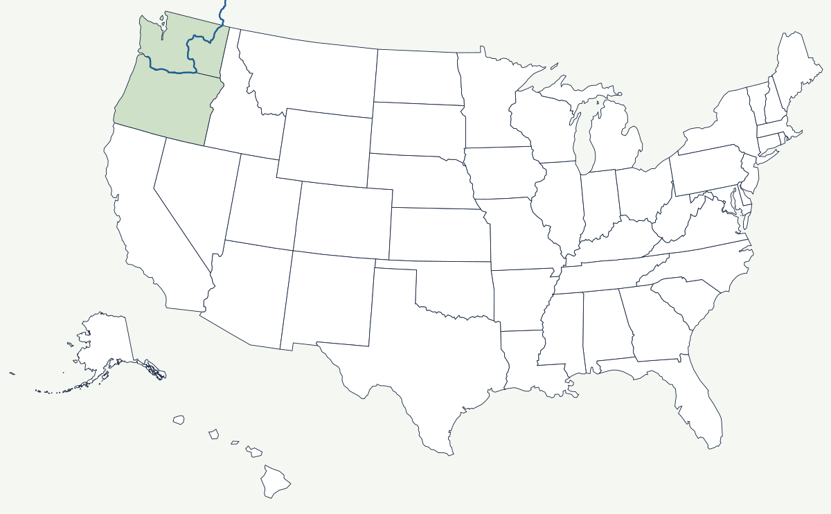
The Columbia rises in Columbia Lake in British Columbia, enters Washington in the northeast corner of the state, loops around the dry Columbia Plateau in a wide bend, and turns west to the Pacific at Astoria. Fourteen dams stand on the main stem, three in Canada and eleven in the United States, and between them they have converted most of the river's 2,600-foot drop into power.
Which states does the Columbia River cross?
The main stem runs through Washington and then along the Washington–Oregon line for roughly 300 miles. Its basin, however, reaches much further: the Snake River brings water from Idaho, Wyoming and Nevada, the Clark Fork and Kootenai drain western Montana, and a corner of Utah lies inside the watershed too. Seven states and one Canadian province feed the same mouth.
| Source | Columbia Lake, British Columbia |
| Mouth | Pacific Ocean at Astoria, Oregon |
| Length | about 1,240 miles, roughly 500 of them in Canada |
| Drainage basin | about 258,000 square miles in seven US states and British Columbia |
| Largest tributary | the Snake River |
| Largest dam | Grand Coulee, the largest electricity producer in the United States |
| Columbia River Gorge | the only near-sea-level breach through the Cascade Range |
Notable places along the river
Portland sits on the Willamette a few miles above its junction with the Columbia, and ocean ships still reach it about 100 river miles from the sea. The Columbia River Gorge cuts through the Cascades at near sea level, an 80-mile canyon with waterfalls on the Oregon wall and reliable wind that made it a windsurfing center; Bonneville Dam, completed in 1938, sits inside it. Grand Coulee Dam, finished in 1942 far upstream, has no fish ladders and blocked salmon from the upper river permanently. At the mouth, the Columbia Bar — the shifting shoal where the river meets Pacific swell — has wrecked enough ships to earn its own pilot service.
How the river shaped the Northwest
The Columbia was the reason Britain and the United States argued over the Oregon Country: both wanted the river as their boundary. The Oregon Treaty of 1846 rejected that and drew the line on the 49th parallel instead, leaving the whole navigable river American and giving Washington and Oregon a river border rather than a mountain one. The federal dam program that followed in the 1930s and 1940s gave the region the cheapest electricity in the country, which in turn brought aluminium smelters, the Hanford plutonium works and, much later, data centers. The cost fell on the salmon runs and on the tribes who depended on them: Celilo Falls, the oldest continuously used fishing site in North America, disappeared under the pool behind The Dalles Dam in 1957.
The Columbia's largest tributary has its own page, the Snake River map; the range it cuts through is covered by the Cascade Range map, and its mouth by the Pacific Coast map. See the physical geography of the United States, or the state pages for Oregon and Washington.