US Map / Geography / Pacific Coast
Pacific Coast Map
The West Coast has almost no natural harbors, and every major city is at one of the few.
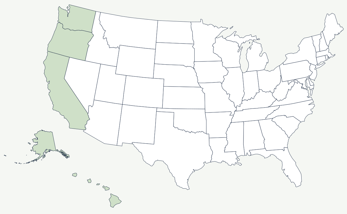
The Pacific shore is a young, rising, tectonically active margin. Mountains come down to the water, the shelf is narrow, rivers are short and steep, and the cold California Current keeps the summers foggy and the water too cold to swim in for most of its length. There are very few places where a ship can get out of the weather, and the map of West Coast settlement is essentially a list of those places.
Which states are on the Pacific Coast?
Five. California has about 840 miles of general coastline, from the Oregon line to the Mexican border. Oregon has roughly 296 miles, almost all of it publicly accessible by state law. Washington has about 157 miles of outer coast plus the whole of Puget Sound behind the Olympic Peninsula. Alaska has more shoreline than all the other states combined — around 6,640 miles of general coastline and tens of thousands of miles once the islands and fjords are traced. Hawaii adds about 750 miles across eight main islands.
| State | General coastline | Principal harbor |
|---|---|---|
| Alaska | about 6,640 miles | Cook Inlet and the Southeast fjords |
| California | about 840 miles | San Francisco Bay; San Diego Bay |
| Hawaii | about 750 miles | Pearl Harbor and Honolulu |
| Oregon | about 296 miles | the Columbia River mouth; Coos Bay |
| Washington | about 157 miles of outer coast | Puget Sound |
The harbors, and the cities that grew at them
San Francisco Bay is the only large break in 800 miles of California coast, and it is so well hidden behind the Golden Gate that Spanish ships sailed past it for two centuries; it was found from land in 1769. When gold was discovered eighty years later, the bay was the only place a fleet could anchor, and San Francisco and later Oakland became the entire West Coast's port of entry. San Diego has the other natural harbor in California, which is why the Navy is there. Los Angeles and Long Beach had no harbor at all — the busiest container port complex in the country sits in a shallow bay that was dredged and breakwatered into existence beginning in 1899. In the north, Puget Sound is a drowned glacial trough deep enough for anything afloat, and Seattle sits on it; Portland works as a seaport a hundred river miles inland, past the bar at the Columbia's mouth.
A coast that is still moving
The San Andreas fault runs onshore for much of California — through the San Francisco peninsula and down the Carrizo Plain — then goes out to sea north of San Francisco and stays offshore to its northern end near Cape Mendocino. It is a strike-slip boundary: the coastal strip is sliding northwest past the rest of the continent rather than diving under it. North of Mendocino the geometry changes. The Cascadia Subduction Zone lies offshore from northern California to Vancouver Island, and it last ruptured on 26 January 1700 — a date known precisely because the tsunami it sent across the Pacific was recorded in Japanese records and matched to tree rings in drowned coastal forests. The same subduction feeds the volcanoes of the Cascade Range inland. Meanwhile the cold current and the summer fog belt support the coast redwoods, the tallest trees on Earth, in a narrow strip from Big Sur to the Oregon line.
The coast's mountains stand in front of the Sierra Nevada and the Cascade Range; the largest river reaching it is the Columbia. The opposite seaboard is the Atlantic Coast. See the physical geography of the United States, or the state pages for California and Oregon.