US Map / County Maps / Illinois
Illinois County Map
One Illinois county holds two-fifths of the state; the other 101 divide the rest.
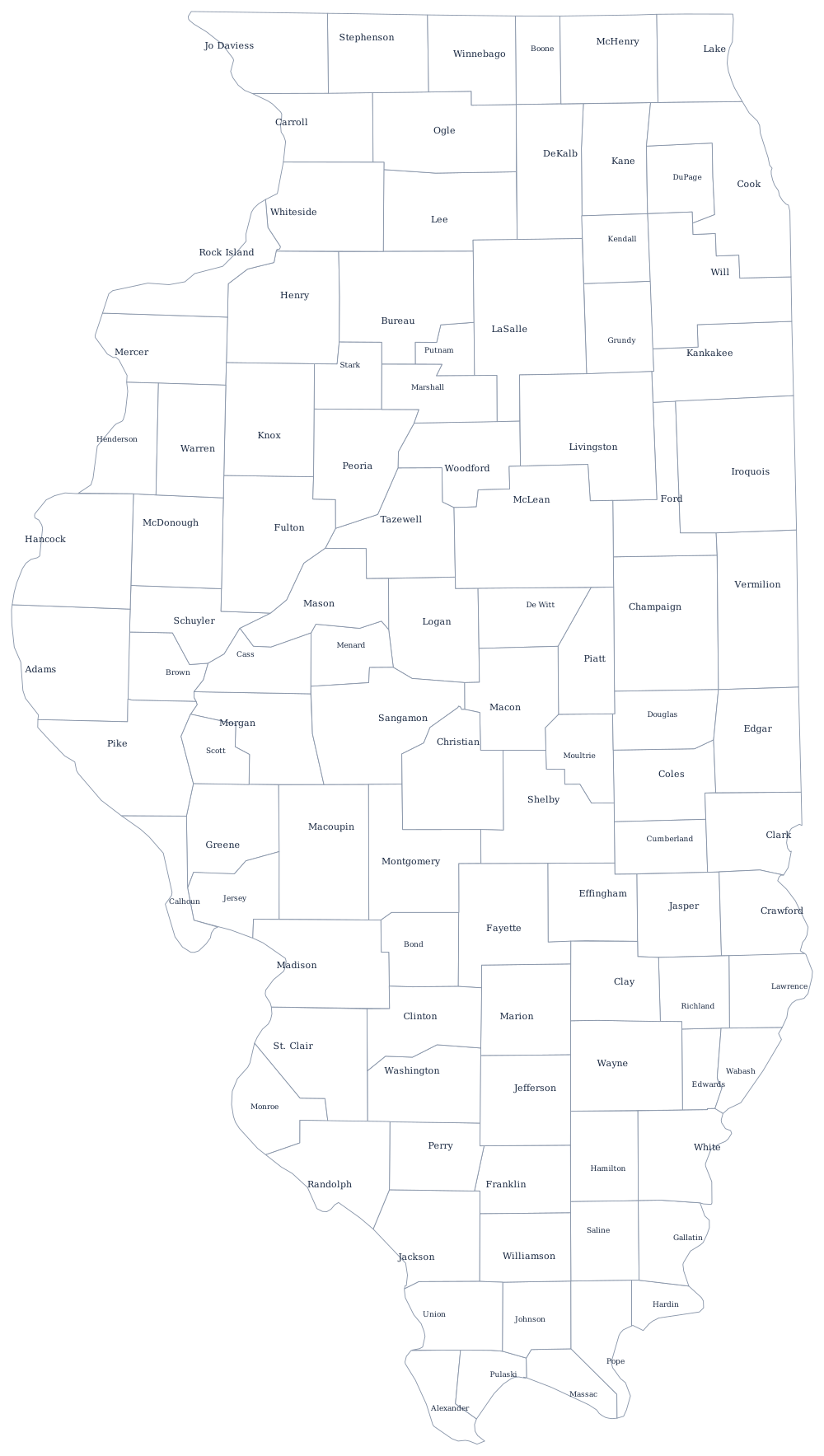
Illinois was organized from the bottom up. St. Clair County, created in 1790 around Kaskaskia and Cahokia, is older than the state by twenty-eight years, and the southern counties that followed it were drawn along rivers because rivers were the roads. North of that first tier the surveyors had already ruled the land into townships, and counties were assembled from whole survey townships — which is why so much of the state's county map is made of rectangles about twenty-four miles on a side.
The 102 counties of Illinois
Cook County alone is 41% of Illinois. Add the five collar counties — DuPage, Lake, Will, Kane, and McHenry — and the top ten reach 74% of the state's population.
| County | County seat | Population (2024 estimate) |
|---|---|---|
| Cook County | Chicago | 5,182,617 |
| DuPage County | Wheaton | 937,142 |
| Lake County | Waukegan | 718,604 |
| Will County | Joliet | 708,583 |
| Kane County | Geneva | 520,997 |
| McHenry County | Woodstock | 315,959 |
| Winnebago County | Rockford | 283,790 |
| Madison County | Edwardsville | 263,017 |
| St. Clair County | Belleville | 251,149 |
| Champaign County | Urbana | 212,374 |
Townships, thousands of governments, and one enormous county
Illinois has more units of local government than any other state — well over 6,000 — and the county is only the top layer of them. Eighty-five of the 102 counties are township counties, subdivided into townships that maintain rural roads and assess property; the other seventeen, mostly in the south, are commission counties where the county board does that work directly. Below both sit school districts, park districts, fire protection districts, sanitary districts, mosquito abatement districts, and drainage districts, each with its own board and its own levy.
Cook County is a government of a different order. Its board president runs an organization with a public hospital system, one of the largest unified court systems in the world by caseload, and a jail complex that is among the largest single-site jails in the country. The board has seventeen commissioners elected by district, and separately elected are the sheriff, the state's attorney, the assessor, the treasurer, the clerk, and the Board of Review — an unusually long ballot that is a recurring subject of consolidation proposals.
Largest and smallest counties
Cook County is the second most populous county in the United States, 5,182,617 people in 2024, and it contains Chicago. DuPage County follows at 937,142 and Lake County at 718,604. The smallest is Hardin County, 3,550 residents in the far south where the Ohio River meets the hills — a county with no incorporated place over a thousand people. McLean County, in the middle of the state, is the largest by land area at about 1,180 square miles.
The Illinois state page sets the counties against the state's cities, and the county map index lists all 50. Around the edges: Wisconsin, Iowa, Missouri, Kentucky, and Indiana. The Mississippi River page traces the western county line from Galena to Cairo.