US Map / County Maps / West Virginia
West Virginia County Map
West Virginia's county map is the list of counties that refused to leave the Union — plus two that were added over Virginia's objection.
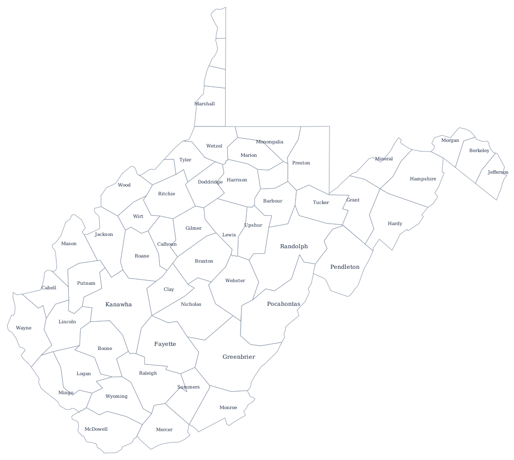
West Virginia is the only state whose county map is a political roll call. When Virginia seceded in 1861, delegates from the trans-Allegheny counties met at Wheeling, repudiated the ordinance, and formed a loyal government; the new state admitted in 1863 was built from the forty-eight counties named in the statehood act, and its boundary is simply the outer edge of those counties. That is why the state has the shape it has, panhandles and all.
The 55 counties of West Virginia
West Virginia has no county over 200,000. Kanawha, which is Charleston and the chemical valley, has been the largest since the 1920s, but Berkeley County in the eastern panhandle — commuting distance from Washington — has been gaining on it for thirty years. The ten below hold 51% of the state.
| County | County seat | Population (2024 estimate) |
|---|---|---|
| Kanawha County | Charleston | 173,906 |
| Berkeley County | Martinsburg | 136,287 |
| Monongalia County | Morgantown | 108,697 |
| Cabell County | Huntington | 91,489 |
| Wood County | Parkersburg | 82,757 |
| Raleigh County | Beckley | 72,379 |
| Harrison County | Clarksburg | 64,472 |
| Jefferson County | Charles Town | 61,264 |
| Mercer County | Princeton | 57,524 |
| Putnam County | Winfield | 57,067 |
The counties that seceded from a secession
Two of the 55 were not part of the original bargain. Berkeley and Jefferson counties, in the lower Shenandoah Valley, were added in 1863 by a referendum that Virginia said had been conducted improperly and under military occupation. Virginia sued, and the case ran to the Supreme Court, which decided Virginia v. West Virginia in 1871 in West Virginia's favor, and they brought the count to fifty. Five more counties — Grant and Mineral in 1866, Lincoln in 1867, Summers in 1871, and Mingo in 1895 — were carved out of existing ones afterwards, bringing the total to 55.
Each county is governed by a county commission of three, which sits both as an administrative body and, in some matters, as a court of record — it hears probate, settles estates, and canvasses elections. Alongside it the county elects a sheriff, who is also the county treasurer, plus a prosecuting attorney, assessor, circuit clerk, and county clerk. Counties are subdivided into magisterial districts that determine commission seats. Because the state's coal and gas property is assessed at the county level, a county's finances can swing sharply with the price of coal, and the southern coalfield counties have lost both population and tax base for six decades.
Largest and smallest counties
Kanawha County is the most populous at 173,906 in the 2024 estimates and contains Charleston, the state capital. Berkeley County is second at 136,287 and is the fastest-growing county in the state. The smallest is Wirt County on the Little Kanawha River, 4,924 people, with its courthouse at Elizabeth, the county's only incorporated town. Randolph County, in the high Alleghenies, is the largest by land area at roughly 1,040 square miles.
The West Virginia state page covers the mountains and the rivers, and the county map index covers all 50 states. Bordering county maps: Virginia, which it left, Maryland, Pennsylvania, and Ohio. The Ohio River page follows the western boundary, which belongs to West Virginia bank to bank.