US Map / County Maps / New Jersey
New Jersey County Map
New Jersey abolished the word freeholder in 2021, ending the last use of a term that had described its county boards since 1798.
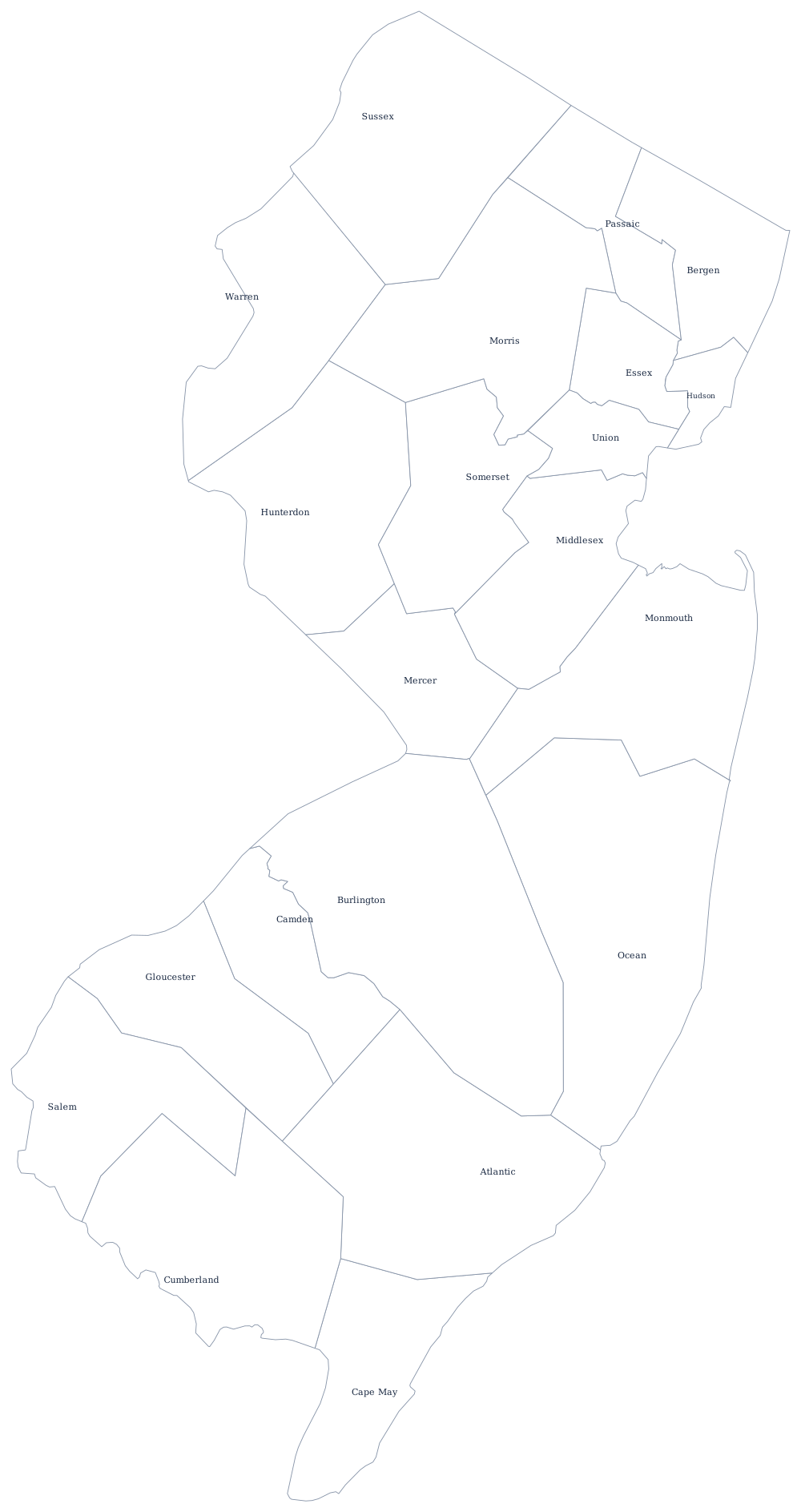
New Jersey's counties are old and small: four were created in 1683, the last, Union, in 1857, and the largest of them would be a middling county almost anywhere west of the Appalachians. Because the state has 564 municipalities packed into 7,400 square miles and no unincorporated land at all, county government in New Jersey sits between two crowded layers and has to justify itself constantly.
The 21 counties of New Jersey
The ten below hold 73% of the state, and eight of them are within thirty miles of Manhattan or Philadelphia. Bergen County, directly across the Hudson from New York City, has been the most populous since the 1950s.
| County | County seat | Population (2024 estimate) |
|---|---|---|
| Bergen County | Hackensack | 978,641 |
| Middlesex County | New Brunswick | 890,119 |
| Essex County | Newark | 881,527 |
| Hudson County | Jersey City | 736,185 |
| Ocean County | Toms River | 666,434 |
| Monmouth County | Freehold | 647,520 |
| Union County | Elizabeth | 594,160 |
| Camden County | Camden | 533,988 |
| Passaic County | Paterson | 526,597 |
| Morris County | Morristown | 523,053 |
From chosen freeholders to county commissioners
Until 2021 every New Jersey county was run by a Board of Chosen Freeholders, a title that went back to 1798 and, before that, to the colonial requirement that a man own land free of debt in order to hold office. New Jersey was the only state still using it. A law signed in August 2020 renamed every board a Board of County Commissioners effective 1 January 2021; the members are now county commissioners, and the county's chief elected officer, where there is one, is a county executive.
The powers did not change. New Jersey counties maintain about 6,500 miles of county road, run the county college and the vocational school district, operate the jail and the prosecutor's office, and manage park systems that in Essex County's case predate every other county park system in the country — it was founded in 1895. Five counties have adopted the county executive form under the 1972 optional charter law; the rest are run by the commissioners collectively. The surrogate, sheriff, and county clerk are elected separately in all 21.
Largest and smallest counties
Bergen County is the most populous at 978,641 in the 2024 estimates, narrowly ahead of Middlesex County at 890,119 and Essex County at 881,527 — the last of which contains Newark. Hudson County, which contains Jersey City, is the densest county in the state and one of the densest in the country. The smallest is Salem County in the south-west on the Delaware River, 65,874 people; only Cape May County is also under 100,000. Burlington County is the largest by land area at about 800 square miles, most of it Pine Barrens.
Go to the New Jersey state page for the shore and the corridor, or the county map index for the rest. The neighbors: New York, Pennsylvania, and Delaware across the bay. The Atlantic Coast page follows the shoreline that gives Ocean, Atlantic, and Cape May counties their names.