US Map / County Maps / Mississippi
Mississippi County Map
Ten Mississippi counties are cut into two judicial districts, each with its own courthouse and its own chancery clerk.
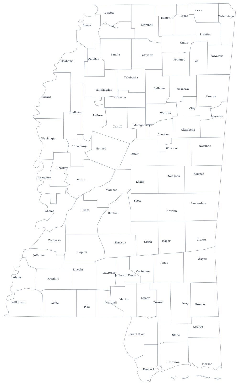
Mississippi's counties were created in waves as Native land was ceded. The oldest sit along the river and the Gulf; the north and center were organized in a rush after the treaties of Dancing Rabbit Creek in 1830 and Pontotoc Creek in 1832, when the legislature carved sixteen counties out of the Chickasaw and Choctaw cessions almost at once. That is why so much of the northern half of the state is a tidy grid and the Delta is not.
The 82 counties of Mississippi
Two of the ten keep two county seats each: Harrison County holds court at both Gulfport and Biloxi, and Hinds County at Jackson and Raymond. The ten together are 46% of the state.
| County | County seat or seats | Population (2024 estimate) |
|---|---|---|
| Harrison County | Gulfport and Biloxi | 213,730 |
| Hinds County | Jackson and Raymond | 211,975 |
| DeSoto County | Hernando | 195,871 |
| Rankin County | Brandon | 160,573 |
| Jackson County | Pascagoula | 147,002 |
| Madison County | Canton | 114,247 |
| Lee County | Tupelo | 83,012 |
| Forrest County | Hattiesburg | 78,435 |
| Lauderdale County | Meridian | 70,588 |
| Lamar County | Purvis | 66,734 |
Beats, supervisors, and the sting that changed county government
Each Mississippi county is governed by five supervisors elected from districts still universally called beats. Under the old beat system each supervisor ran his own beat as a small fiefdom: his own road crew, his own gravel pit, his own equipment shed, and his own purchasing. It made a supervisor the most useful man in a rural county and it made purchasing almost impossible to audit.
That ended in the late 1980s. Operation Pretense, an FBI investigation that ran from 1984 to 1987 using a fake supply company, produced charges against dozens of county supervisors across the state for taking kickbacks on culverts and road equipment; 55 were convicted. The legislature responded in 1988 with a law requiring counties either to adopt a unit system, with one county-wide road department and centralised purchasing, or to hold a referendum on keeping beats. Most counties moved to the unit system, and the county administrator became a real job. The other survival from the nineteenth century is the split county: ten counties, including Harrison, Hinds, Bolivar, Panola, and Tallahatchie, run two judicial districts with separate courthouses because a river or a distance made one courthouse impractical.
Largest and smallest counties
Harrison County on the Gulf Coast is the most populous at 213,730 in the 2024 estimates, just ahead of Hinds County, which contains Jackson, the state capital, at 211,975. The smallest is Issaquena County in the Delta, 1,295 people — the least populous county east of the Mississippi River, in a county whose only incorporated town is Mayersville, the county seat. Yazoo County, where the Delta meets the hills, is the largest by land area at about 920 square miles.
The Mississippi state page has the state's rivers and coast, and the county map index has every state. Around it: Louisiana, Arkansas, Tennessee, and Alabama. The Mississippi River page explains the western boundary and why it no longer matches the water.