US Map / County Maps / North Dakota
North Dakota County Map
North Dakota built 53 courthouses for a population that has never reached a million, and it still keeps all of them.
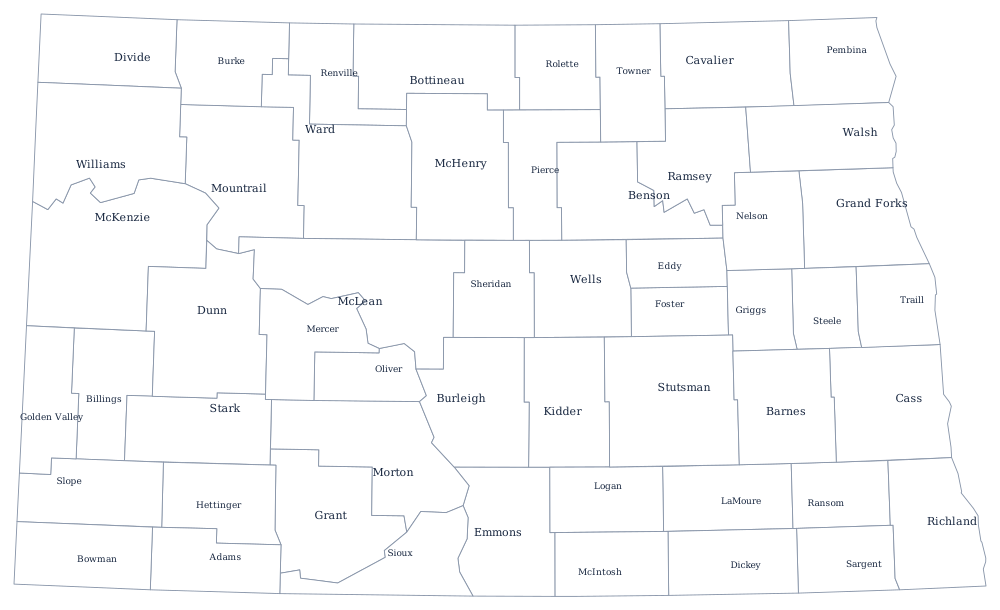
Dakota Territory's legislature created counties faster than settlers arrived, sometimes on the promise of a railroad that never came. The Great Dakota Boom of the 1880s filled the Red River valley, the second boom after 1898 filled the center and west, and by 1916 the state had its 53 counties. Almost every one is a rectangle of survey townships, and the seats were placed to be reachable by wagon.
The 53 counties of North Dakota
Cass County, which is Fargo, is the largest and is nearly double Burleigh, which is Bismarck and the state capital. The ten below hold 76% of North Dakotans.
| County | County seat | Population (2024 estimate) |
|---|---|---|
| Cass County | Fargo | 200,945 |
| Burleigh County | Bismarck | 103,107 |
| Grand Forks County | Grand Forks | 73,771 |
| Ward County | Minot | 68,427 |
| Williams County | Williston | 40,763 |
| Morton County | Mandan | 34,194 |
| Stark County | Dickinson | 33,767 |
| Stutsman County | Jamestown | 21,546 |
| Richland County | Wahpeton | 16,658 |
| McKenzie County | Watford City | 14,782 |
Fifty-three counties, and the ones the oil found
North Dakota's counties were sized for a farm economy of quarter sections and horses, and that economy is long gone. More than half of them have fewer than 4,000 residents and a dozen have fewer than 2,000, yet each still elects a board of commissioners, an auditor, a treasurer, a sheriff, a state's attorney, and a recorder, and each maintains a courthouse. The state has tried repeatedly to encourage consolidation; voters have never approved a merger. What they have done instead is combine offices and share state's attorneys and highway engineers across county lines.
The Bakken shale changed part of the map after 2008. McKenzie, Williams, Mountrail and Dunn counties, which had been losing people since the 1930s, gained them rapidly — McKenzie County roughly tripled in a decade — and county governments that had run on a few million dollars a year suddenly had to build roads, water systems, and jails for oilfield traffic. The rest of the western counties kept emptying. Amidon, the seat of Slope County, has about twenty residents and is among the smallest incorporated county seats in the country.
Largest and smallest counties
Cass County in the Red River valley is the most populous at 200,945 in the 2024 estimates, 25% of the state, and Burleigh County is second at 103,107. The smallest is Slope County in the south-west corner, 660 people. McKenzie County, in the heart of the Bakken, is the largest by land area at about 2,740 square miles.
The North Dakota state page covers the valley and the badlands, and the county map index covers the rest. Bordering county maps: Minnesota, South Dakota, and Montana. The Missouri River page follows the water that divides the prairie counties of the east from the badlands of the west.