US Map / County Maps / Maine
Maine County Map
Half of Maine has no town government at all, and in that half the county is the only local authority there is.
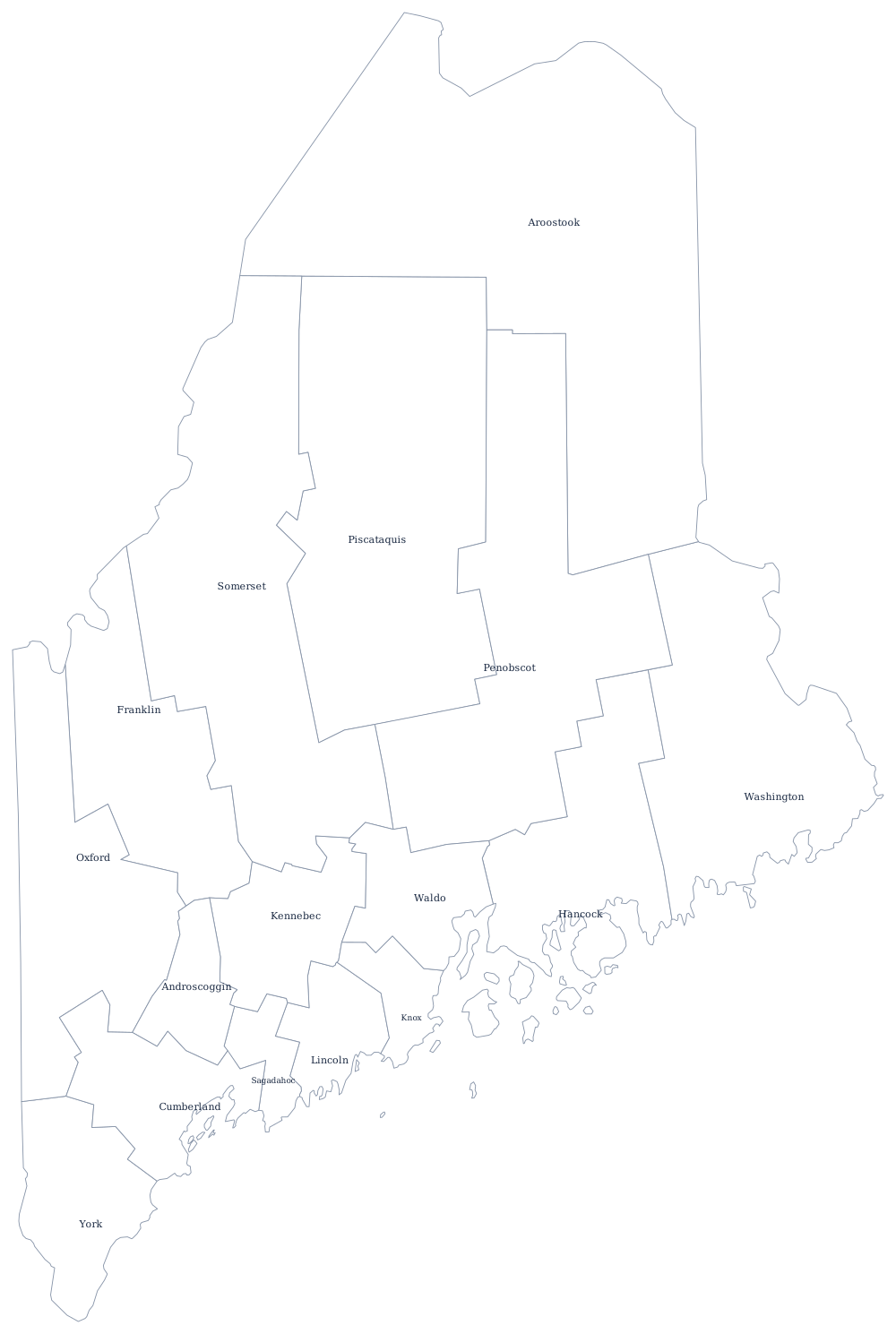
Maine calls a county seat a shire town, a usage it kept from Massachusetts, which governed the district until 1820. Nine counties existed at statehood and the last, Aroostook, was set off in 1839 during the boundary dispute with New Brunswick that nearly became a war. The line the treaty finally drew in 1842 is why Aroostook has the shape it does, and why so much of Maine's county map is a single county.
The 16 counties of Maine
Cumberland and York, the two southernmost, hold about a third of the state between them. The ten below are 86% of Maine's population.
| County | Shire town | Population (2024 estimate) |
|---|---|---|
| Cumberland County | Portland | 313,809 |
| York County | Alfred | 220,143 |
| Penobscot County | Bangor | 156,840 |
| Kennebec County | Augusta | 128,461 |
| Androscoggin County | Auburn | 115,272 |
| Aroostook County | Houlton | 66,776 |
| Oxford County | Paris | 60,039 |
| Hancock County | Ellsworth | 56,946 |
| Somerset County | Skowhegan | 51,338 |
| Knox County | Rockland | 40,981 |
The Unorganized Territory, where the county is the government
Maine counties are thin governments in the settled parts of the state. They run the jail, the sheriff, the registry of deeds, and the probate court, and almost nothing else: schools, roads, police, fire, zoning and welfare all belong to the 480-odd towns and cities. New England put its local power in the town meeting three centuries ago and never moved it.
Then there is the other Maine. About half the state's land area — some 10 million acres of commercial forest in the north and west — lies in the Unorganized Territory, hundreds of townships with no municipal government of any kind and roughly nine thousand year-round residents between them. There the county assumes the town's role, providing services and levying a property tax collected by the state, while land use is regulated by the state Land Use Planning Commission rather than a local board. Many of these townships have no name, only a survey designation such as T5 R7 WELS — township five, range seven, west of the Easterly Line of the State.
Largest and smallest counties
Cumberland County, which contains Portland, is the most populous at 313,809 in 2024, 22% of Maine, and York County to its south is second at 220,143. The smallest is Piscataquis County in the Moosehead Lake country, 17,432 people spread over nearly 4,000 square miles, and fewer than the county held in 1920. Aroostook County is much the largest by land area, about 6,670 square miles of potato ground and commercial forest.
See the Maine state page for the coast and the mountains, or the county map index for the rest of the country. Maine touches only New Hampshire, but the same town-first pattern runs through Vermont and Massachusetts. The New England region page explains why.